National Grid Hosting Capacity Map
Feeder-level hosting capacity for National Grid's upstate New York territory — on the same map as parcels, ownership, substations, and the live SIR interconnection queue.
Explore the Map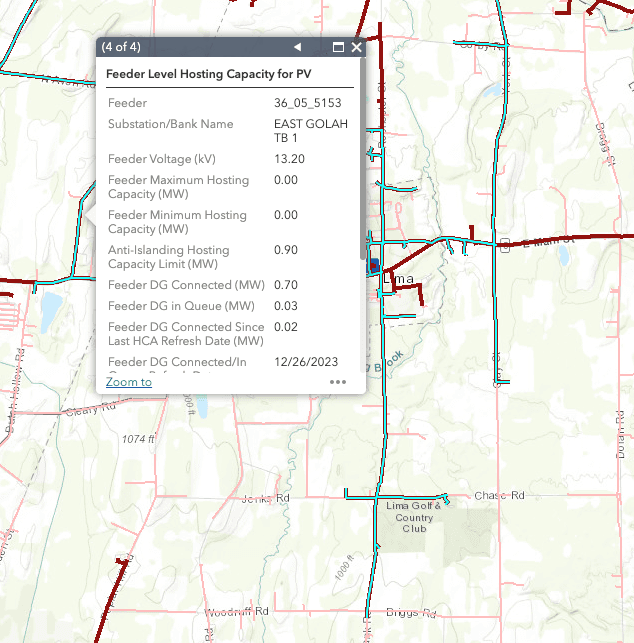
Where National Grid's hosting capacity data comes from
National Grid publishes hosting capacity for its New York distribution system through its System Data Portal, one of the commitments the Joint Utilities of New York made under the state's REV proceedings. The map reports how much distributed generation each feeder can take before significant upgrades are needed, expressed as a minimum and maximum for each circuit.
It's genuinely useful data — and a frustrating place to work. The portal is a standalone GIS viewer with no parcel boundaries, no ownership information, and no connection to the interconnection queue. You can see that a feeder has headroom, but not who owns the land under it, whether the ground is buildable, or how many projects are already queued at the substation it feeds.
The same data, with the context that makes it actionable
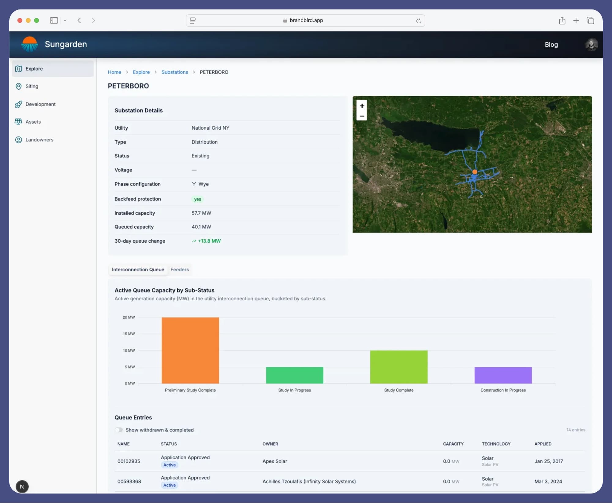
Sungarden keeps National Grid's hosting capacity map in sync and layers it with everything the portal leaves out: parcel boundaries and ownership for landowner outreach, wetlands and slope for buildability, and New York's SIR queue mapped to each substation so you can see queued megawatts before you commit to a site. Filter for feeders with capacity above your project size, then work outward to the parcels around them.
National Grid also publishes feeder load curves, and Sungarden tracks them — so beyond a static capacity number, you can see how a circuit actually behaves across the day. When a queued project withdraws and capacity frees up at a substation, Sungarden alerts you.
What Sungarden loads for National Grid
- Feeder-level hosting capacity
- Feeder geometry and attributes
- Substations
- Feeder load curves
- Parcel boundaries and ownership (New York)
- Interconnection queue, mapped to substations
Frequently asked questions
What is a hosting capacity map?
A hosting capacity map shows how much distributed generation — like solar — each distribution feeder can accommodate without triggering significant system upgrades. Utilities publish it at the feeder level, usually as a range, so developers can screen locations before filing an interconnection application.
Where does National Grid publish its hosting capacity map?
National Grid publishes hosting capacity for its upstate New York service territory through its System Data Portal, as part of the Joint Utilities of New York's distributed system implementation commitments. The portal is a standalone GIS viewer — it shows feeders and capacity values, but no parcels, ownership, or queue context.
What do minimum and maximum hosting capacity mean?
Hosting capacity varies along the length of a feeder, so utilities report it as a range. Capacity is typically highest near the substation and drops toward the end of the line. A parcel near the feeder's backbone may see close to the maximum value, while one at the feeder's edge may not even get the minimum.
Does hosting capacity tell me what interconnection will cost?
No. Hosting capacity is a screening tool. Actual interconnection costs are determined by the utility's impact study (a CESIR in New York). But screening with hosting capacity and queue position together dramatically improves your odds: a feeder with headroom and no queued projects ahead of you is far less likely to come back with a seven-figure upgrade bill.
How current is the data in Sungarden?
Sungarden syncs National Grid's published hosting capacity, substation, and feeder data on a regular schedule, and monitors New York's SIR interconnection queue continuously — including alerts when projects withdraw and capacity frees up at a substation.
Other New York hosting capacity maps
Or start from the New York hosting capacity overview to compare every utility in the state on one map.
Find your next site on National Grid's system.
Get Started For FreeFree during beta
Sungarden is an independent platform and is not affiliated with or endorsed by National Grid. Hosting capacity and system data are sourced from National Grid's published datasets and are intended for screening only — not as a substitute for a utility interconnection study.