December 12, 2023
Utility Hosting Capacity Maps
A Quick intro to hosting capacity maps
As distributed generation becomes more commonplace, utilities have started offering digital maps that detail the capacity for new distributed generation interconnection at the feeder level. These maps are invaluable for solar developers, as they can help guide our site search to areas where interconnection would not involve costly infrastructure upgrades, and eliminate areas where interconnection would be cost-prohibitive.
Included Info
 While the available information varies from utility to utility, there are a few common attributes available for each
feeder segment shown on the map:
While the available information varies from utility to utility, there are a few common attributes available for each
feeder segment shown on the map:
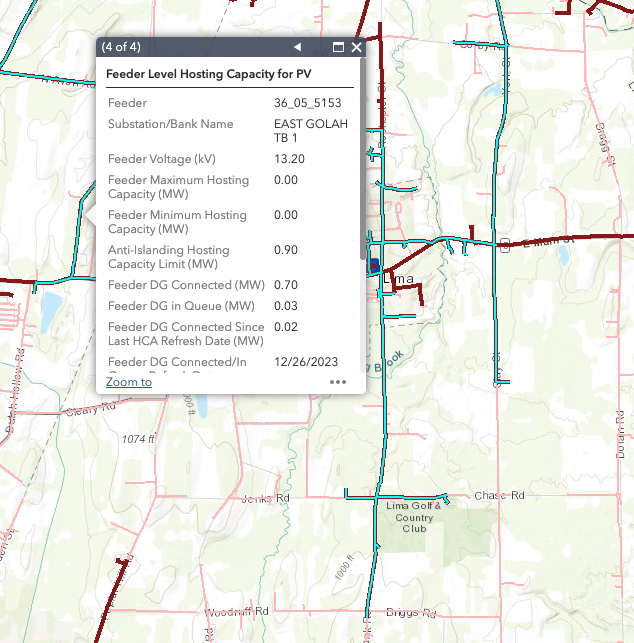
Feeder ID: The number or other identifier the utility uses to identify the feeder.
Voltage: The nominal voltage of the feeder or feeder segment, typically in kV.
Maximum Hosting Capacity: The maximum amount of Distributed Generation capacity that the feeder or feeder section can accommodate. Typically in MW.
Minimum Hosting Capacity: The minimum amount of DG capacity that the feeder or section can accommodate. This is typically the capacity at the point on the feeder farthest from the substation. MW.
DG Capacity In Queue/Connected: The amount of DG capacity that is currently connected to, or in the interconnection queue for the feeder, in MW
Substation: The substation the feeder is connected to.
In addition, utilities may provide additional information that could be useful for interconnection applications. This may include islanding and flicker constraints, or substation features, such as 3V0 protection and other upgrades. Utilities often provide detailed user guides for their maps that list and define the included attributes. In addition to feeder level data, some utilities provide additional data at the substation level or more granular levels, down to individual feeder segments between utility poles.
Using Hosting Capacity Maps in Sungarden
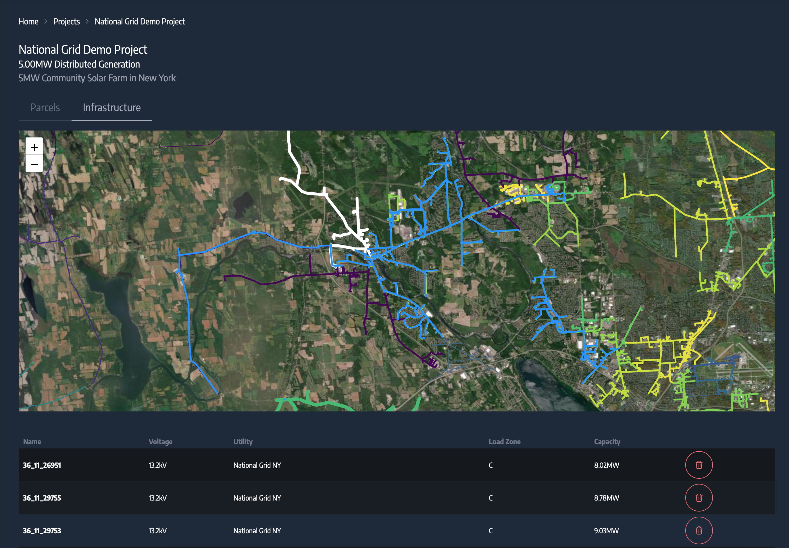
Let's take a look at how we can use the integrated hosting capacity maps available in sungarden to streamline our parcel search. As an example, lets take a look at how we might find potential locations for a 6MW Solar Array in New York. Starting with our new project, we can start with feeders. In Sungarden, these are available natively. The feeders info and hosting capacity you see in the image below are sourced from the National Grid hosting capacity map.
Here we've selected a few feeders with sufficient hosting capacity. Once we flip back to the parcels tab we can see that parcels meeting our size criteria near the selected lines are displayed on the map
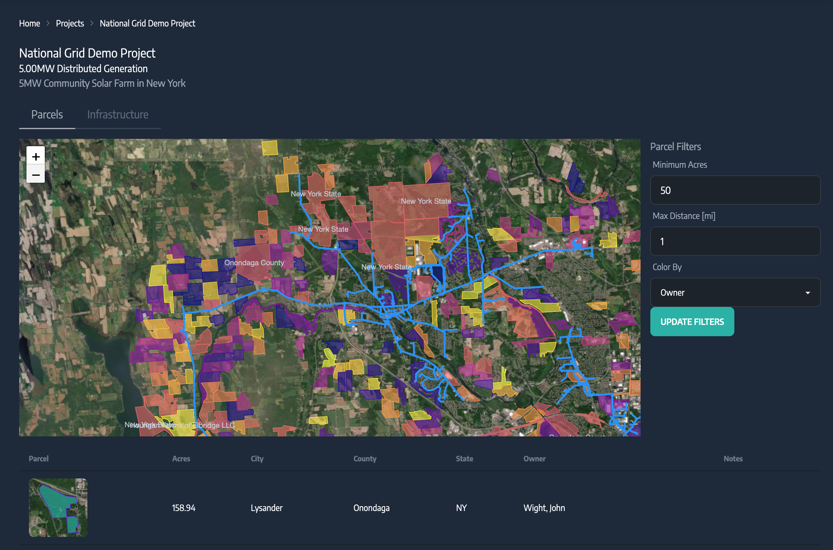
From this point on we can use the built-in tools and layers to evaluate the potential sites suitability based on environmental, legal, and other key factors.